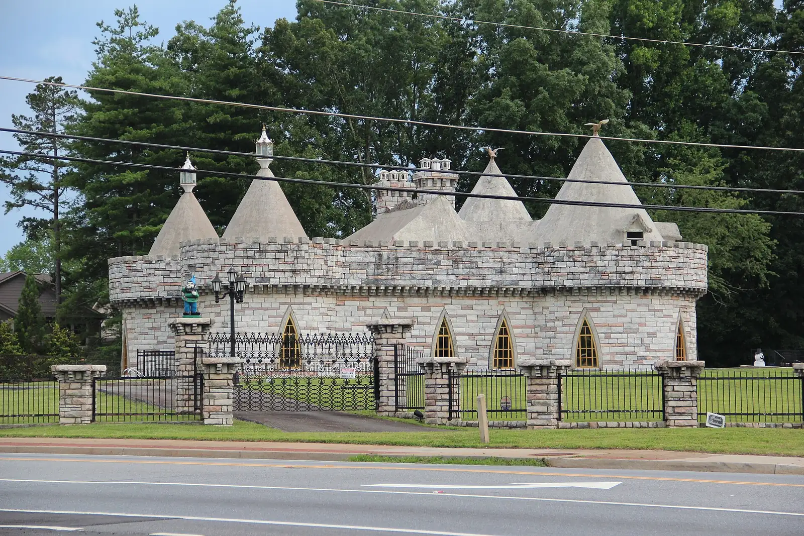
Milton's eight character areas from the city's plan, each with its ZIP code, zoned high school and August 2026 Zillow home value, and a map.
Last checked Oct. 6, 2026. Sources: the City of Milton’s 2040 Comprehensive Plan (PDF), character area narratives (PDF), character areas map layer, address points and neighborhoods layer, Fulton County Schools’ 2025-26 zone map, the state’s 2025 School Grades data, Zillow Research, the Census Bureau, MARTA and OpenStreetMap.
Milton has no list of official neighborhoods with legal boundaries. What it has is a map. The city’s 2040 Comprehensive Plan, adopted by the City Council on Oct. 4, 2021, divides the whole city into eight character areas, each with a written description of what is there and what the city wants for it. This guide uses those eight areas, exactly as the city draws them, and gives each one its own page.
What this means for you
- Find your schools: zones do not follow area or city lines. Use the district’s Find Your School lookup.
- Check the city line: many Milton homes have an Alpharetta or Roswell mailing address, and the reverse. The parcel record with the Fulton County Board of Assessors settles it.
- Compare the cities: our Milton vs. Alpharetta vs. Roswell vs. Johns Creek guide sets out tax rates, schools and home values side by side.
How Milton is laid out
Milton is in north Fulton County, with Cherokee County to the north and west, Forsyth County to the northeast, Alpharetta to the south and east, and Roswell to the southwest. The city had 41,546 residents in the Census Bureau’s 2020-2024 American Community Survey estimates. Its eight character areas cover about 25,000 acres.
Georgia 400 does not run through Milton. The nearest exits are 10, Old Milton Parkway, and 11, Windward Parkway, in Alpharetta, close to Deerfield in the city’s southeast corner. Highway 9 (Georgia 9) runs along the east side, Birmingham Highway (Georgia 372) north from Crabapple to Birmingham, and Arnold Mill Road (Georgia 140) through the southwest. Hopewell Road and Freemanville Road cross the rural middle.
Of the 14,538 active residential address points the city publishes, 95% are in ZIP code 30004, 3% in 30009, 1% in 30075 and a few dozen in 30040. Each of those ZIP codes also covers homes in other cities. The federal school directory lists Milton High, which is inside the city, with an Alpharetta address.
School zones do not follow city limits either. Fulton County Schools zones 55% of Milton’s residential addresses to Cambridge High, 22% to Milton High and 22% to Alpharetta High, which is in Alpharetta; 47 addresses in the southwest are zoned for Roswell High. On the state’s 2025 School Grades report, the College and Career Ready Performance Index scores were 93.0 for Alpharetta High, 92.8 for Milton High, 92.7 for Cambridge High and 85.3 for Roswell High; the state average for high schools was 76.9.
The areas at a glance
Typical values are the Zillow Home Value Index for August 2026, a modeled typical value for the middle third of homes, not a sale price. Shares are of each area’s residential address points.
| Area | Main ZIP code | Zoned high school (most addresses) | Typical value, main ZIP |
|---|---|---|---|
| Crabapple | 30004 | Milton (100%) | $757,088 |
| Birmingham | 30004 | Cambridge (52%), Milton (48%) | $757,088 |
| Central Milton | 30004 | Cambridge (69%) | $757,088 |
| Bethany | 30004 | Cambridge (100%) | $757,088 |
| Milton Lakes | 30004 and 30009 | Cambridge (96%) | $757,088 (30004) |
| Deerfield | 30004 | Alpharetta (63%) | $757,088 |
| Arnold Mill | 30075 and 30004 | Milton (100%) | $703,778 (30075) |
| Sweetapple | 30075 | Milton (53%), Roswell (47%) | $703,778 |
Zillow’s citywide Milton figure was $946,504, up 2.83% from August 2025. ZIP 30004 was up 0.71% on the year, 30009 ($759,646) up 2.27% and 30075 up 1.27%. Because these ZIP codes reach into Alpharetta and Roswell, the ZIP figures run lower than the city figure. Recent sales are in our weekly real estate transfers.
The map
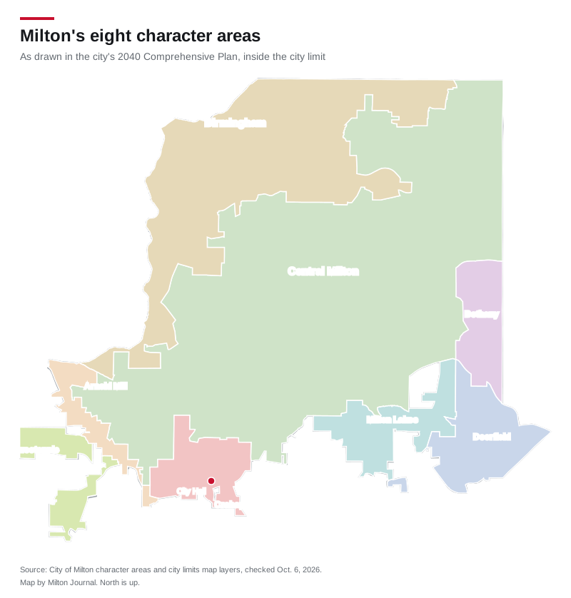
Map drawn by Milton Journal from the City of Milton’s character areas and city limits map layers. Street maps of each area: © OpenStreetMap contributors.
The eight areas
Crabapple is the downtown, around the crossroads of Crabapple Road and Birmingham Highway, with City Hall, the Green, Milton High, Northwestern Middle and Crabapple Crossing Elementary. Every address is zoned for Milton High.
Birmingham is the rural north along the Cherokee County line, with horse farms, the 200-plus-acre Birmingham Park and a Publix at the Birmingham Crossroads. High school zones split almost evenly between Cambridge and Milton.
Central Milton is the largest area, about 14,024 acres of large lots, gravel roads and subdivisions, with Bell Memorial Park and Milton City Park and Preserve. It has 127 developments in the city’s neighborhoods layer.
Bethany is the residential strip along Highway 9 on the east edge, including the Crooked Creek golf community, zoned entirely for Cambridge High.
Milton Lakes runs along Hopewell and Cogburn Roads in the south, with Providence Park, Cambridge High, Hopewell Middle and Cogburn Woods Elementary.
Deerfield is the business district closest to Georgia 400, with offices, shopping on Highway 9 and the city’s apartments: 48% of its addresses are apartments or units. It is the only area with MARTA service.
Arnold Mill is the corridor along Georgia 140 in the southwest, with Legacy Park. The city adopted a small area plan for it on May 5, 2025.
Sweetapple is the plan’s “most rural” area, in two pieces bordered by Roswell, with Lakhapani Preserve on Lackey Road.
Getting around
Each area guide gives the nearest Georgia 400 exit, the distance to City Hall and the distance to Hartsfield-Jackson Atlanta International Airport, measured on the OpenStreetMap road network with the OSRM routing engine. They range from about 1.4 miles to an exit from Deerfield to about 9 miles from the Birmingham Crossroads, and from about 37 to 43 miles to the airport. MARTA’s schedule data shows bus stops only in and beside Deerfield, on routes 140 and 185.
How we built this
- The areas are the eight character areas in the City of Milton’s 2040 Comprehensive Plan and its character areas map layer, with the city’s own names. We did not add or redraw any. The city is updating the plan; its 2026 update page scheduled a council vote for Oct. 5, 2026, and says the 2040 plan’s community vision carries over.
- ZIP codes, apartments and school zones come from every active residential address point in the city’s map data, placed in Fulton County Schools’ 2025-26 zones on Oct. 6, 2026. Development and HOA counts come from the city’s neighborhoods layer.
- Place names such as Crabapple, Birmingham, Hopewell and Webb are also marked in OpenStreetMap; we name individual subdivisions only where the city’s own layer names them.
- Scores are 2025 CCRPI figures from the Governor’s Office of Student Achievement. Home values are Zillow’s August 2026 index.
Frequently asked questions
What are the neighborhoods in Milton, Georgia?
The city’s 2040 Comprehensive Plan divides Milton into eight character areas: Crabapple, Birmingham, Central Milton, Bethany, Milton Lakes, Deerfield, Arnold Mill and Sweetapple. Crabapple is the downtown and Deerfield the main business district.
What ZIP codes are in Milton?
Mostly 30004, which covers 95% of Milton’s residential addresses in the city’s map data. About 3% use 30009, 1% use 30075 in the southwest and a few dozen on the northeast edge use 30040. All four ZIP codes also cover homes outside the city.
What high schools serve Milton?
Fulton County Schools zones 55% of Milton’s residential addresses to Cambridge High, 22% to Milton High and 22% to Alpharetta High, which is in Alpharetta. A few dozen southwest addresses are zoned for Roswell High. Zones do not follow city limits.
What is the typical home value in Milton?
Zillow’s citywide figure was $946,504 in August 2026, up 2.83% on the year. By ZIP code it was $757,088 in 30004, which also covers part of Alpharetta. It is a modeled typical value, not a sale price.
Does MARTA serve Milton?
Only the Deerfield area. MARTA route 140 stops along Deerfield Parkway, Morris Road, Webb Road and Highway 9, and route 185 has one stop on Windward Parkway inside the city line, according to MARTA’s schedule data.
Have your say